World
Hurricane Milton follows Helene on track for Florida

The Florida governor’s office declared a state of emergency for affected areas and mass evacuations were underway.
According to the US National Hurricane Center (NHC), “Milton has the potential to be one of the most destructive hurricanes on record for west-central Florida.”
Terms such as “historic” “catastrophic” and “unprecedented” have been used for both Milton and Helene – and indeed for an increasing number of extreme events in different parts of the globe.
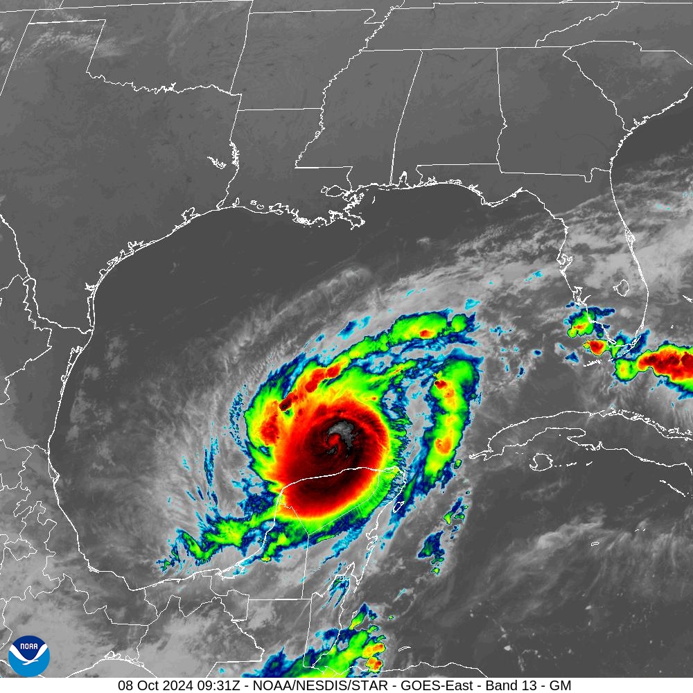
Maximum sustained winds are near 155 mph (250 km/h) with higher gusts, according to the latest update from NHC, which said Milton is a powerful category 4 hurricane on the Saffir-Simpson Hurricane Wind Scale, having reached the top-level category 5. While fluctuations in intensity are expected, Milton is forecast to remain an extremely dangerous hurricane through landfall in Florida.
Milton intensified at an explosive rate – an increasingly common occurrence as witnessed with Hurricane Beryl in July. It was the third most rapid intensification in the Atlantic basin, according to the NHC.
Ocean heat in the Gulf of Mexico is playing a role because warm sea surface temperatures provide the energy necessary for hurricanes to intensify. The deeper the warmer water, the more energy a storm can draw.
Tropical-Storm-Force Wind Speed Probabilities – 08/10 to 10/10
NOAA
Milton is also a large hurricane, with hurricane-force winds extend outward up to 30 miles (45 km) from the center and tropical-storm-force winds extend outward up to 80 miles (130 km). It is expected to grow in size.
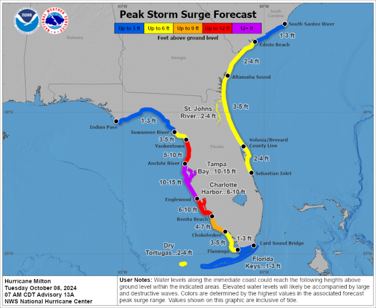
A large area of destructive storm surge will occur along parts of the west coast of Florida on Wednesday. This is an extremely life-threatening situation.
In Mexico, a storm surge will raise water levels by as much as 4 to 6 feet (1.2 – 1.8 m) above ground level along the northern coast of the Yucatan Peninsula in areas of onshore winds. Near the coast, the surge will be accompanied by large and destructive waves.
In the populated Tampa Bay area in the USA, storm surge may be as much as 10-15 feet (3 to 4.5 meters).
The combination of a dangerous storm surge and the tide will cause normally dry areas near the coast to be flooded by rising waters moving inland from the shoreline.
Rainfall amounts of 5 to 10 inches (12.7 to 25.4 cm), with localized totals up to 15 inches, are expected across portions of the Florida Peninsula through Thursday. This rainfall brings the risk of considerable flash, urban, and areal flooding, along with moderate to major river flooding.
Milton will make landfall in Florida, just as Helene did 10 days ago, but at a different location (in the Fort Meyers area, close to where Hurricane Ian made its landfall in 2022). Ian was also category 5.
Then, Milton is expected to cross Florida State and exit into the Atlantic Ocean.
There are currently three hurricanes spinning in the Atlantic – Milton, Leslie and Kirk. This is quite exceptional for the month of October.
Kirk is currently a category 1 hurricane but will weaken and become an ex tropical cyclone as it hits Europe on Wednesday.
The major impacts will be in France. Meteo-France is forecasting that Kirk will be a dangerous storm, with wind gusts up to 110 km/h at the coast and up to 90 km/h inland, and heavy rainfall , from Loire region to Lorraine region, including Paris area.

Peak Storm Surge Forecast – Hurricane Milton – 08/10/24
NOAA


